
Barrington Lane serves as your gateway to the Barrington Bay Trail system on Oak Island, offering direct access to one of the island’s most intriguing coastal exploration routes where legend and landscape intersect. This residential access point puts you within minutes of windswept shoreline, salt marshes teeming with wading birds, and stretches of beach where treasure hunters have combed the sand for over two centuries.
What sets this particular access point apart is its role as the primary entry to a trail network that winds past locations tied to Oak Island’s treasure legend. Local guides frequently begin their expeditions here, and for good reason. The path leads you through ecosystems that shift from maritime forest to open beach, revealing why explorers past and present have found this stretch of coastline so compelling.
Most visitors spend between two and four hours exploring from this starting point, though those captivated by the island’s enigmatic history often linger longer. The trail difficulty ranges from easy to moderate depending on tide conditions and how far you venture along the connected paths. Whether you’re drawn by the promise of unsolved mysteries or simply seeking a picturesque coastal hike away from crowded tourist beaches, Barrington Lane delivers an authentic Oak Island experience where every turn might reveal something unexpected.
Why Visit Barrington Lane
Barrington Lane offers a rare combination of natural splendor and historical intrigue that few other spots on Oak Island can match. This scenic access point puts you at the doorway to coastal exploration while keeping you connected to the island’s legendary mysteries.
The lane serves multiple purposes for visitors:
- Direct access to the extensive Barrington Bay Trail network
- Panoramic coastal vistas across Mahone Bay’s island-dotted waters
- Wildlife observation in both marine and woodland habitats
- Walking distance to active treasure hunting sites, including the Money Pit remake
- Exceptional photography opportunities at golden hour
What makes Barrington Lane particularly valuable is its accessibility for various visitor types. History enthusiasts can contemplate the treasure hunt’s evolution while standing where searchers have walked for generations. Nature lovers find themselves immersed in coastal Nova Scotia’s distinctive ecosystem, where salt air meets dense forest. Adventure seekers appreciate the trail system’s moderate challenge, offering enough variety to stay interesting without requiring extreme fitness levels.
The location also provides something increasingly rare: a genuine sense of discovery. Unlike heavily commercialized attractions, Barrington Lane retains an authentic, uncrowded atmosphere. You can explore at your own pace, follow your curiosity down side paths, and experience Oak Island as locals do rather than as just another tourist stop.
Key Areas Along Barrington Lane
1. Barrington Bay Trailhead Access
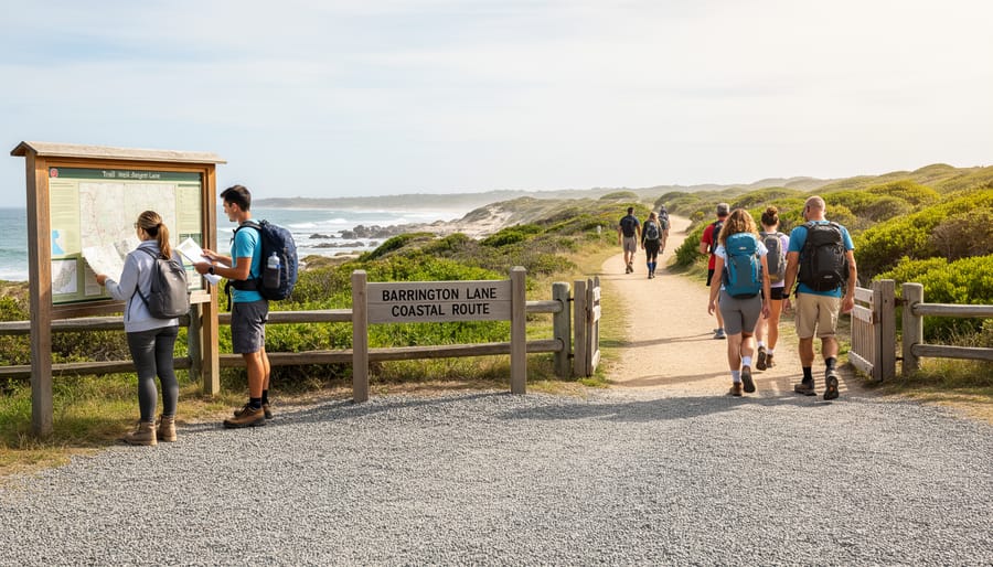
The trailhead sits approximately 200 meters down Barrington Lane from the main road, marked by a wooden kiosk displaying a trail map and basic safety information. You’ll find a small gravel parking area that accommodates roughly eight vehicles, though it fills quickly during summer weekends and holiday periods.
The signage here orients visitors to the 2.3-kilometer loop trail ahead, with clearly marked directional arrows pointing toward both the coastal route and the woodland alternative. A weathered bulletin board posts current trail conditions, tide warnings, and occasional wildlife sightings reported by previous hikers.
Expect a well-maintained dirt path leading from the parking area, wide enough for single-file hiking. The initial 50 meters pass through a transitional zone where manicured properties give way to natural coastal vegetation. Early morning visitors often spot deer grazing near this entrance before human activity picks up.
There’s no fee for trail access, but the area lacks facilities like restrooms or water fountains. The trailhead’s exposed position means wind can be surprisingly strong even when conditions seem calm from Barrington Lane itself.
2. Coastal Overlook Point

The trail opens to a dramatic viewing platform roughly 400 meters from the trailhead, where weathered wooden railings frame an unobstructed sweep of Mahone Bay. From this vantage point, you’ll see Oak Island’s position among the 365 islands dotting the bay, with the mainland visible across steel-blue waters that shift from calm to choppy depending on wind conditions.
Photographers flock here during golden hour when sidelight catches the texture of waves and defines the contours of distant islands. Bring a wide-angle lens to capture the bay’s expanse or a telephoto to pick out details on neighboring islands. The overlook sits about 20 feet above the waterline, high enough to appreciate the bay’s scale without feeling vertiginous.
Look northeast toward Chester Basin to understand why treasure hunters chose this location, the protected waters offered safe anchorage, while the island’s isolation provided secrecy. A weathered interpretive panel identifies visible landmarks, though the information has faded from sun and salt exposure.
The overlook remains exposed to wind off the water, so secure loose items and expect cooler temperatures than the forested sections. Early morning visits often reward you with fog banks rolling through the islands, adding atmospheric mystery to your experience.
3. Historic Marker Junction
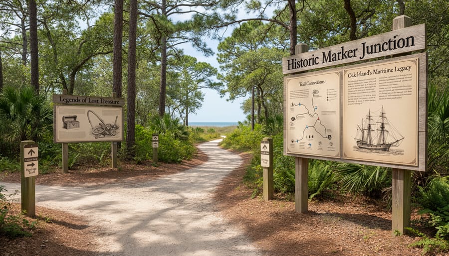
Along the trail, you’ll encounter a cluster of interpretive signs that bring Oak Island’s legendary past into sharp focus. This junction serves as an outdoor museum, where weathered plaques recount centuries of treasure hunting attempts, from the discovery of the original Money Pit in 1795 to modern excavation efforts that continue drawing adventurers worldwide.
The markers detail the island’s maritime significance beyond treasure tales. You’ll learn about the area’s role in colonial shipping routes, the strategic importance of Mahone Bay during periods of conflict, and theories connecting Oak Island to everyone from pirates to the Knights Templar. Each sign presents documented facts alongside enduring mysteries, letting you draw your own conclusions.
What makes this spot particularly engaging is how it transforms your hike into something more than exercise. The signs are positioned where you can gaze across the bay toward Oak Island itself, adding visual context to the stories. Most visitors spend 10 to 15 minutes here, reading and photographing the displays. The junction includes a small clearing with space for groups, making it ideal if you’re exploring with family or friends who want to discuss the theories together.
4. Woodland Loop Connection
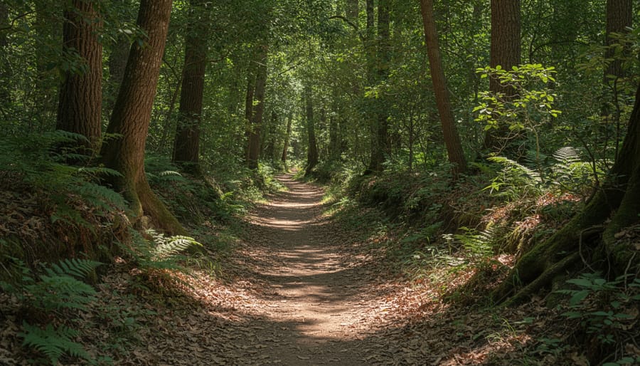
Branching off the main coastal path, this forested detour plunges you into a completely different world within minutes. Dense spruce and maple canopy creates welcome shade on sunny days, and the temperature noticeably drops as you leave the exposed shoreline behind.
The loop stretches roughly half a kilometer through mixed woodland, with a soft carpet of pine needles underfoot dampening your footsteps. This quiet makes it prime territory for spotting Oak Island’s wildlife. White-tailed deer often browse here in early morning, and you might catch red squirrels chattering overhead. Birdwatchers should listen for the distinctive drumming of pileated woodpeckers and the calls of blue jays echoing through the trees.
What makes this section particularly appealing is the contrast it provides. After photographing wide ocean vistas, the intimate scale of the forest path feels almost meditative. The trail markers are clear, and the loop reconnects to the main route near the bay-side rest area, so you won’t lose your bearings. Budget about fifteen minutes if you walk it steadily, or longer if you’re watching for wildlife.
5. Bay-Side Rest Area

About halfway through your coastal journey, you’ll discover a thoughtfully placed rest area where the trail opens onto a small clearing with direct sightlines across Mahone Bay. Two weathered benches face the water, positioned to catch the prevailing breeze and offer respite from the sun on warmer days.
This spot serves as more than just a place to catch your breath. The unobstructed bay views let you scan the horizon toward the mainland and neighboring islands, making it easier to visualize why treasure seekers believed Oak Island’s location was strategically chosen. On calm days, the water’s surface reflects the sky like glass, while rougher conditions showcase the powerful tides that have shaped the island’s shores for centuries.
The area features a small sandy access point where you can touch the water or examine tidal debris washed ashore. Local hikers often pause here for twenty minutes or more, finding the combination of natural beauty and historical contemplation irresistible. It’s an ideal photo opportunity and a natural midpoint for turning back if you’re not tackling the full trail loop.
Practical Information for Visitors
Reaching Barrington Lane is straightforward for anyone planning Oak Island access. The lane branches off Oak Island’s main road system, with clear directional signage appearing approximately halfway down the causeway. Visitors arriving for the guided tram tour will pass near this access point. Parking is available in a small gravel lot at the trailhead, accommodating roughly 8-10 vehicles. Arrive before 10 AM during summer weekends to secure a spot, or visit midweek when the area sees lighter traffic.
| Category | Details | Notes |
|---|---|---|
| Parking | Small gravel lot, 8-10 spaces | Free; arrive early on weekends |
| Duration | 45 minutes to 1.5 hours | Depends on stops and photo breaks |
| Difficulty | Easy to moderate | Some uneven terrain, manageable inclines |
| Best Season | Late spring through early fall | May-October for dry conditions |
| What to Bring | Water, sturdy shoes, camera, bug spray | Sunscreen recommended for coastal sections |
Trail conditions vary with weather. The path consists of packed earth with occasional tree roots and rocky patches along the coastal sections. Recent rainfall can create muddy spots in the woodland areas, so waterproof hiking boots prove useful during spring and after storms. Winter access remains possible, though snow and ice make footing treacherous without proper traction devices.
The route is not wheelchair accessible due to natural terrain variations and narrow sections. Families with young children manage the trail successfully, but strollers won’t navigate the uneven surfaces. Bring your own water, as no facilities exist at the trailhead. Cell service is reliable throughout, unlike some more remote Oak Island locations. Mosquitoes and blackflies peak from late May through July, making insect repellent essential during those months.

Local Tips and Insider Knowledge
Early mornings, especially on weekdays, offer the quietest trail experience and the best light for photography along the coastal stretches. Local hikers know that late spring through early autumn provides the most reliable conditions, though the trail’s off-season charm shouldn’t be dismissed, winter walks reveal clearer bay views through bare branches and fewer insects.
For wildlife enthusiasts, bring binoculars for spotting ospreys and herons in the morning hours, particularly near the bay-side sections where fish activity draws these hunters. The woodland portions occasionally reveal deer tracks, and patient observers sometimes spot red foxes near dusk. Combine your Barrington Lane walk with a visit to the nearby interpretive centre to deepen your understanding of what you’re seeing on the trail, or check out Oak Island Resort tips if you’re planning an extended stay that includes dining and accommodation alongside your exploration. Locals suggest carrying a small trail map even though signage is decent, cell service can be spotty in wooded sections, and having a backup navigation method prevents unnecessary backtracking.
Common Questions About Barrington Lane
Visitors planning to explore Barrington Lane and the Barrington Bay Trail often have similar questions about what to expect. Here are the most common inquiries from travelers preparing their Oak Island adventure.
How difficult is the Barrington Bay Trail?
The trail is rated easy to moderate, with mostly flat terrain and well-maintained paths suitable for most fitness levels. Expect some uneven ground near coastal sections and tree roots in wooded areas.
Are dogs allowed on the trail?
Yes, dogs are welcome on the Barrington Bay Trail but must remain leashed at all times. Please clean up after your pet and be mindful of other hikers sharing the path.
Can I take photos along Barrington Lane and the trail?
Photography is permitted and encouraged throughout the public trail areas. The coastal overlooks and historic markers provide excellent photo opportunities for capturing Oak Island’s scenery and mystery.
Does the trail connect to the Money Pit or other excavation sites?
While the trail doesn’t directly access the Money Pit, the historic marker junction provides context about treasure hunting history, and the coastal views offer perspective on the island’s layout. Active excavation sites remain private property.
These answers cover the basics, but conditions can change seasonally. Check with local visitor centers or Oak Island tourism resources for current trail status and any temporary closures before your visit.